River landscape in Brabant / Stroomruggenlandschap in Brabant
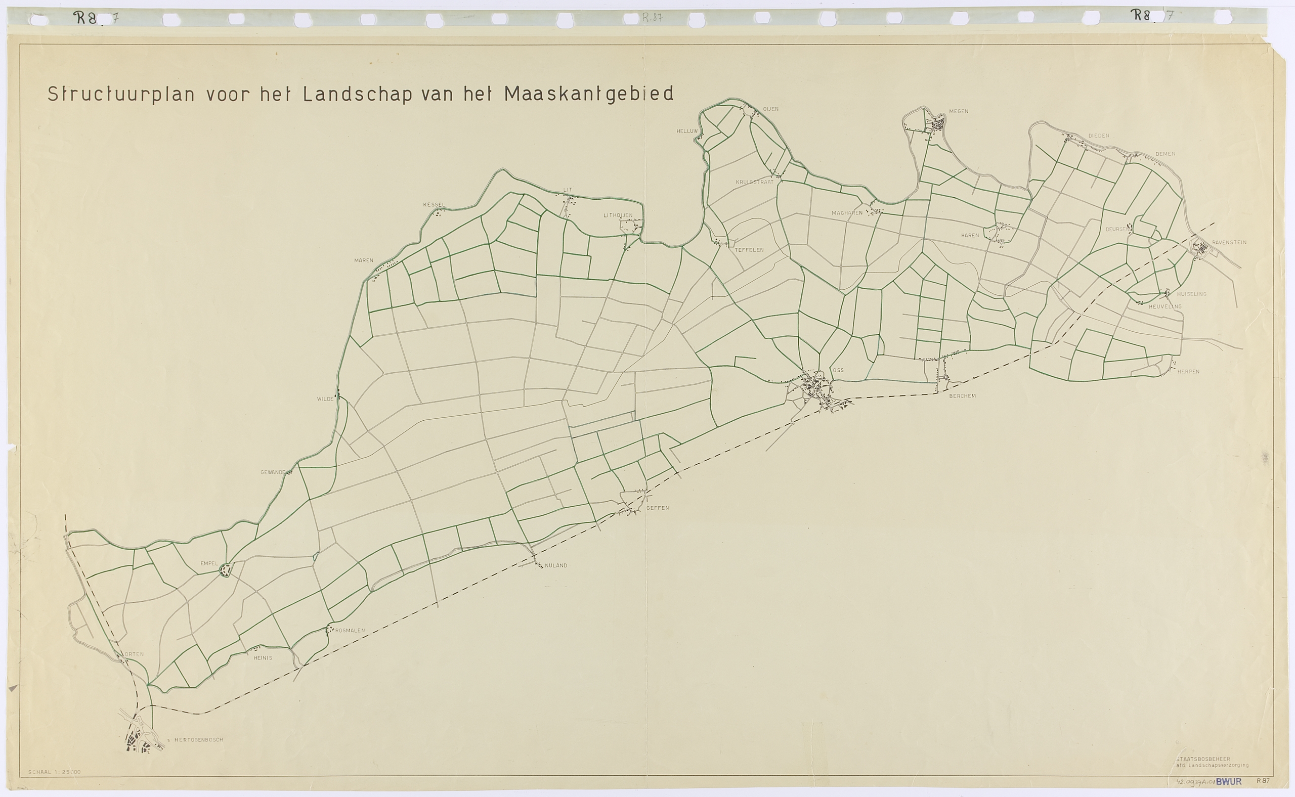
In the river area of Brabant six land consolidations were prepared in the Beersche Overlaat. The Beersche Overlaat is where the Maas created an extra discharge route in the event of heavy precipitation. This spillway was closed after the Maas was canalized in the 1930s and the dykes along it were reinforced.
For Benthem, the landscape plans for the six land consolidations had to be part of a single design. He had Nico de Jonge (1920-1997) design a Structuurplan for the entire Maaskant area.
The plan shows a clear contrast between open and closed areas. At the northern and southern edge of the large open space, planting was projected along the roads, as well as in the villages. At that time, no farms were built in the basin.
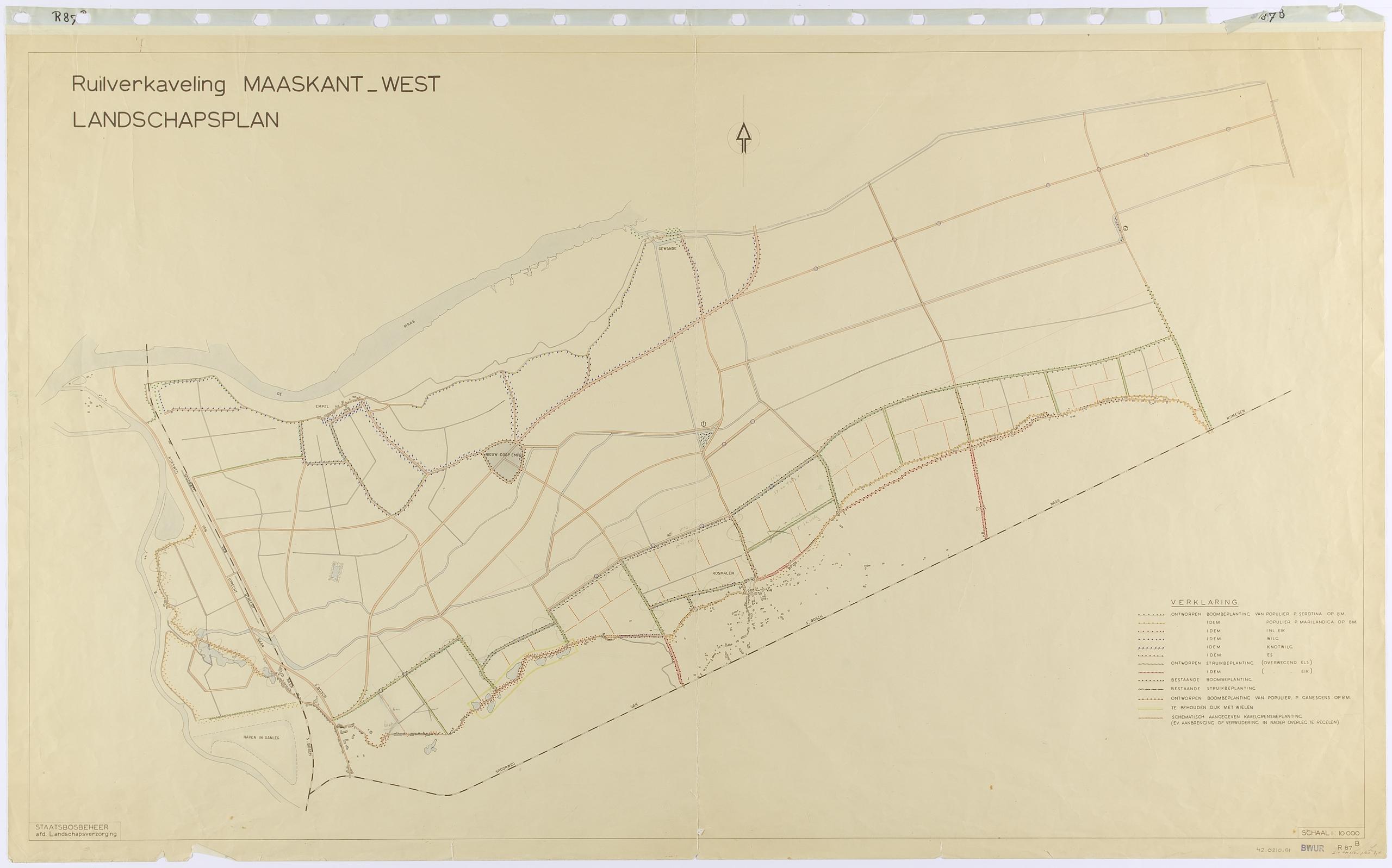
Maaskant-West was the first of the six landscape plans based on the structure plan. The western half is bound by dykes: the Maasdijk in the north, and other dykes along the valley of the Aa and Dieze in the west and south. These dykes, as well as the wheels attached to them and the first roads inside the dykes, were planted. Pollard willows were planted along the Maasdijk and poplars at the Diezedijk. Along the southern dyke, oaks were proposed on the edge of the Brabant sand.
The roads on the embankment along the Maas were given pollard willows, sometimes underplanted with alder bushes. The road that runs on the transition to the basin had ash trees in the verge. Ashes were also projected in the south along the sand into the village centre of Rosmalen. The roads were not planted between the levee and the sand. Here you will still find the wide open basin of Brabant.