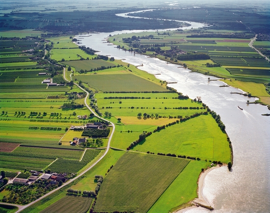
River landscape in Gelderland / Gelderse stroomruggen
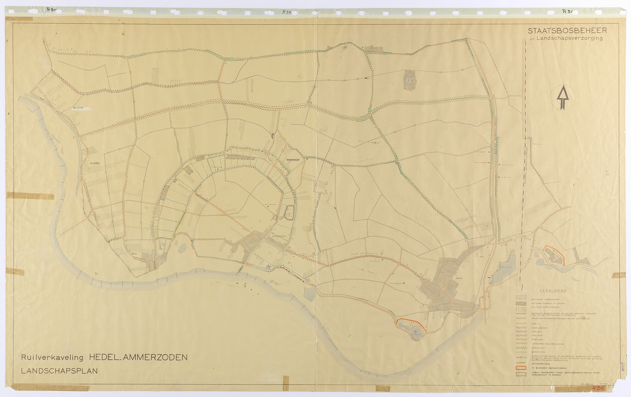
An early Gelderland land consolidation is Hedel-Ammerzoden. The landscape plan was completed in 1947, according to the annual report of Staatsbosbeheer, and was planted in the winter of 1948/49.
Several publications comment upon the “deteriorated land” in the river area before the land consolidation. The farms in the villages destroyed by war were replaced by new farms on the outskirts of the village.
In the swampy basin clay areas, the allotment was modernized and the water management and the road pattern were greatly improved. Initially, no farms were moved to the basin.
In Hedel-Ammerzoden, the roadsides of the new roads laid through the reclamation of the basin are completely planted with long screens of poplar and ash. Cultural-historical elements, such as old dikes and the old monastery and castle grounds in Ammerzoden, are also carefully considered in the design. Some historic duck decoys have been spared in the basins.
Striking in Hedel-Ammerzoden is the structuring role of the old river meander. The two long curving roads on either side are lined with sturdy road plantings. The landscape plan also states that the edges of the plots along the old meander should also be planted.
More information on Hedel-Ammerzoden is available in database TUiN.
De Lek bij Achthoven (Utrecht). Photo: Peter van Bolhuis