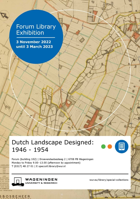
This digital exhibition is a spinoff of the exhibition Dutch Landscape Designed: 1946-1954, that was exhibited at Special Collections-WUR Library from 3 November 2022 until the beginning of April 2023.
Now that topics such as nitrogen reduction, climate change and the transition of rural areas are the focus of attention, the discussion about a new design of the landscape is highly topical.
From 1946 to 1976, a small group of landscape designers created more than 450 landscape plans for the Netherlands. Together, these plans cover almost 70% of the Netherlands. The landscape plans are part of the Staatsbosbeheer Collection of Wageningen UR – Library and have been kept at the Special Collections for over 25 years. The exhibition focusses on the early years of the land consolidation.
Opening exhibition on 3 November 2022.
Guest curator Henk van Blerck obtained his doctorate in May 2022 for his research into the “Netherlands Landscape Plan”. His work is primarily based on the Staatsbosbeheer Collection. In his PhD thesis he concludes that the beauty of the varied Dutch cultural landscape was the main motivation for its designers and that they designed the landscape with a visionary approach on a national scale.
The characteristics of different landscape types formed the basis of the landscape plans. The online exhibition provides information on each landscape type and shows photographs of the landscape itself.
The founding and work of the Landscape Care Department of Staatsbosbeheer (Forestry Commission) is also highlighted.
As is the role of the various disciplines and professors of the Landbouwhogeschool in the development of the landscape plans for the land consolidation program.
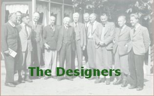
The Designers
Benthem, on the left, took part in the team that prepared prins Claus for his position as a member of the royal family. Photo by courtesy of his family.
Roelof Jan Benthem (1911-2003), from 1946 in a leading role at the department Landscape Care of the Forestry Commission (Staatsbosbeheer), was already interested in nature and active in nature conservation at a young age. In 1943, his fight to preserve Het Bossche Broek gave him a central role within the Working Group for Cultural Landscapes of the Contact Commission for Nature and Landscape Protection.
In 1944 a typology of the Dutch cultural landscape was set up, the first typology produced from an interdisciplinary perspective. Besides this typology Benthem formulated a threefold task for landscape care: the “preservation of existing beauty”, “correction of incorrectly treated landscape” and finally, “promoting the creation of new scenic beauty”. In these tasks he set out what he would achieve in the following decades at Staatsbosbeheer.
Benthem in his younger years. Photo by courtesy of his family
From 1946 to 1976 Benthem led the organization within the Forestry Commission where the landscape plans were made, the department Landscape Care. He designed the first landscape plans and was at the heart of the series. The series of landscape plans can be seen as one artistic undertaking.
Until the Land Consolidation Act of 1954 there was hardly any legal basis for making landscape plans. Nevertheless, from 1946 to 1955, plans were drawn and carried out for nearly 200 land consolidations.
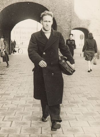
Harry de Vroome. Photo by courtesy of his family.
In 1948 Harry de Vroome and Nico de Jonge were added to the ‘team Benthem’ in Utrecht. De Vroome was trained as a landscape architect at the horticultural school in Frederiksoord. He made a lot of landscape plans for land consolidation projects, regional plans for nature development and designs for estate parks and village greens in the north and east part of the Netherlands. De Jonge had been working at Staatsbosbeheer Zeeland, where he was engaged in the reconstruction of war-damaged areas. Besides landscape plans he also designed the planting of the ramparts of fortified towns and drew up regional landscape plans, which Benthem considered necessary for areas where several land consolidations would take place.
In the office at Maliestraat 9 in Utrecht designers debated the differences between the landscape types and how to incorporate them into the landscape plan. They discussed the landscape’s seclusion and vastness and how to preserve the old while creating new landscape.
Together they developed a vocabulary to express the characteristics of different landscape types through landscape plans.
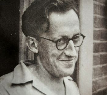
Nico de Jonge. Photo by courtesy of his family.
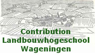
Contribution Landbouwhogeschool Wageningen
Various disciplines of the Wageningen Agricultural College contributed to the ideas and the substantiation of ‘Landscape Plan Netherlands’. In fact, the various disciplines were integrated within this plan.
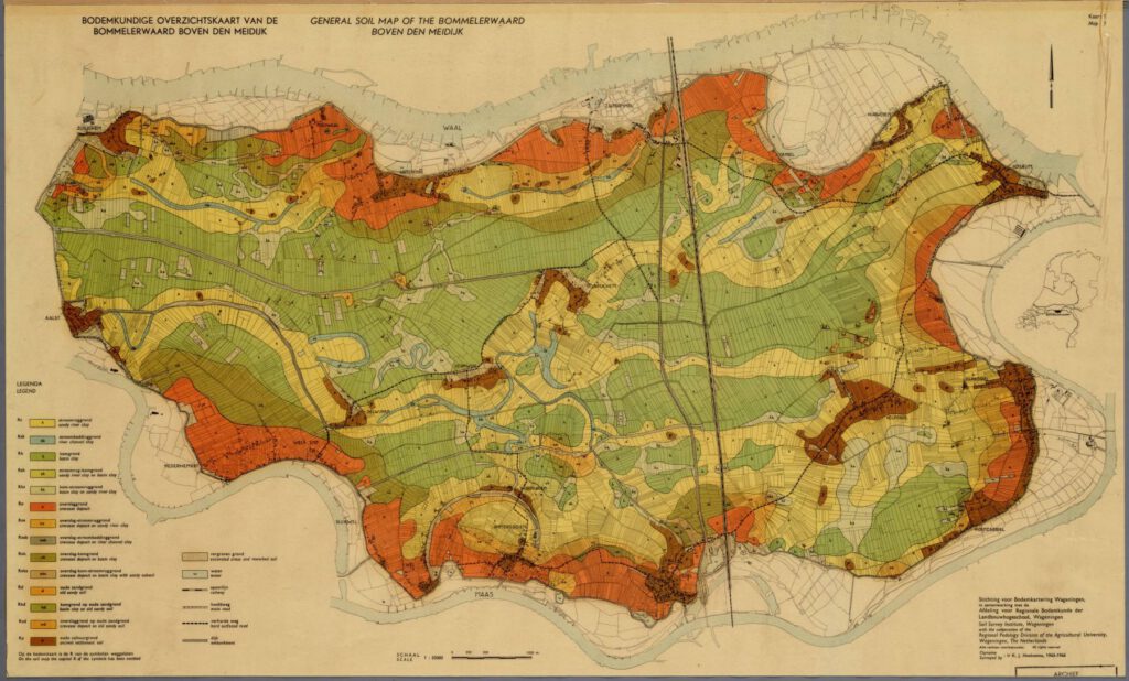
Knowledge in the fields of soil science, geology, geography, forestry, culture technology, garden art and plant systematics was used to draw up the landscape plans.
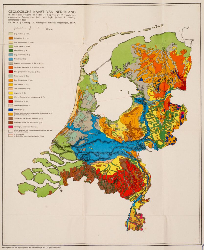
For each land consolidation area a soil survey was carried out by the Stichting voor Bodemkartering (Stiboka), now part of Wageningen Environmental Research. These soil maps and also maps on geography, groundwater, vegetation, flora and fauna, etc. can be found in the Alterra Map Collection.
Usually a scientific report on the land consolidation area was published. These reports are available at WUR – Library.
Scientists, such as Staring, Oosting, Vlam, Edelman, Venema, Bijhouwer, and alumni, such as Mesu, Van Steijn and Overdijkink, were sources of knowledge and their scientific work sources of inspiration.
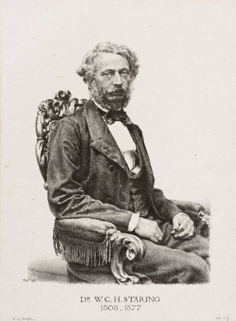
W.C.H. Staring is regarded as the founder of geology and agronomy in the Netherlands. He was also the ‘founding father’ of the Rijkslandbouwschool (National Agricultural School) in Wageningen and thus of WUR.
G.A. Overdijkink studied forestry at the Landbouwhogeschool and worked at Staatsbosbeheer from 1921 to 1962. He advocated and realised the planting of roads and canals and was the first chief of the Staatsbosbeheer departement Landschapsverzorging (Landscape Care). The designers of this department were undoubtedly heavily influenced by Overdijkink.
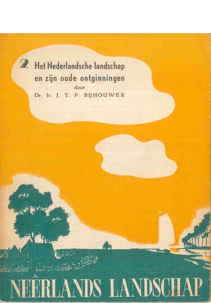
J.T.P. Bijhouwer became the first professor landscape architecture in Wageningen in 1946. In his studies on the Dutch landscape(s) he described different landscape types.
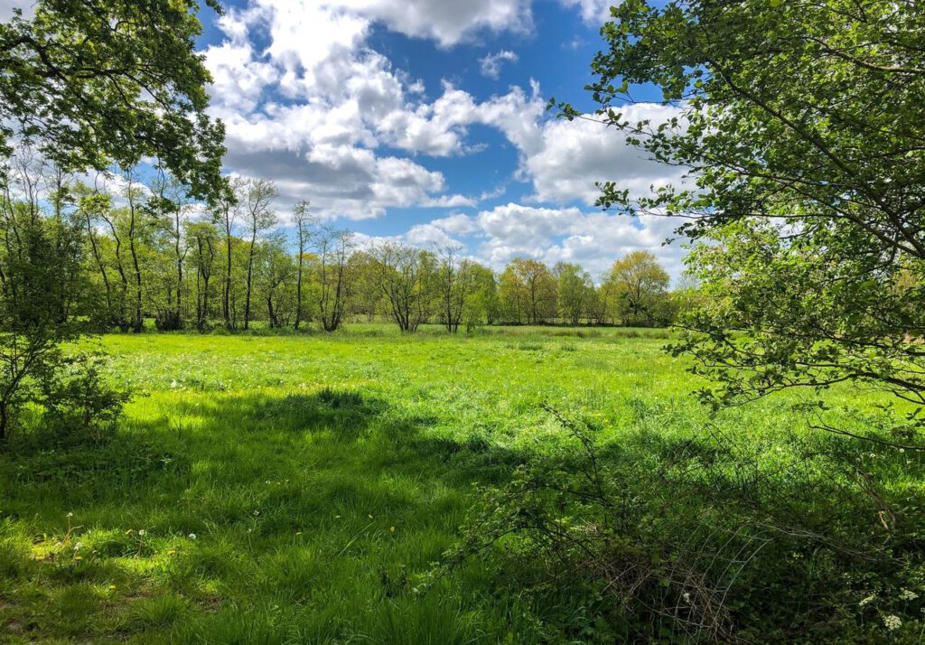
Discover the landscape types
The characteristics of different landscape types formed the basis of the landscape plans. Here you’ll find information and some photographs on each landscape type.
‘Oudehoeven’ landscape / Oudehoevenlandschap
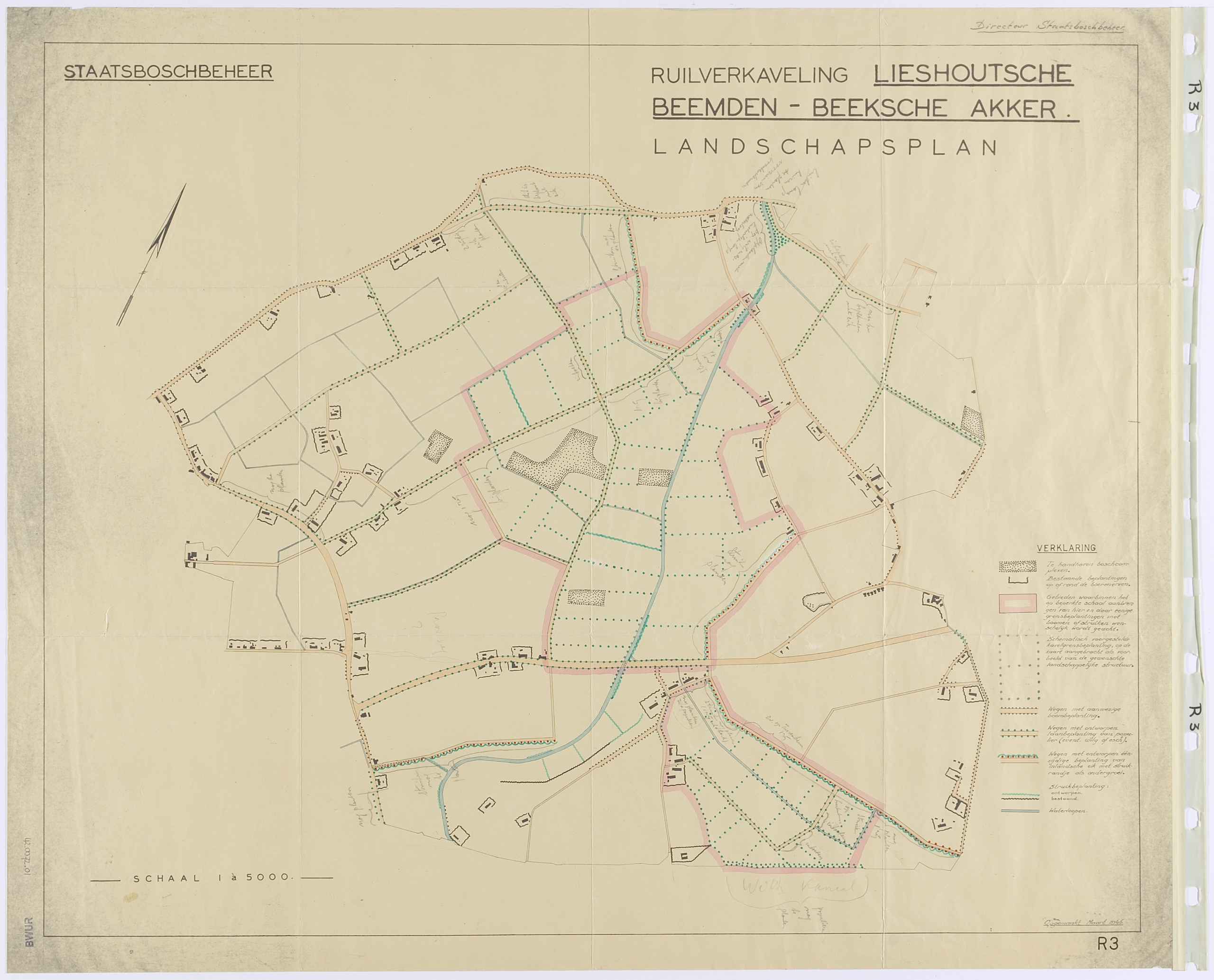
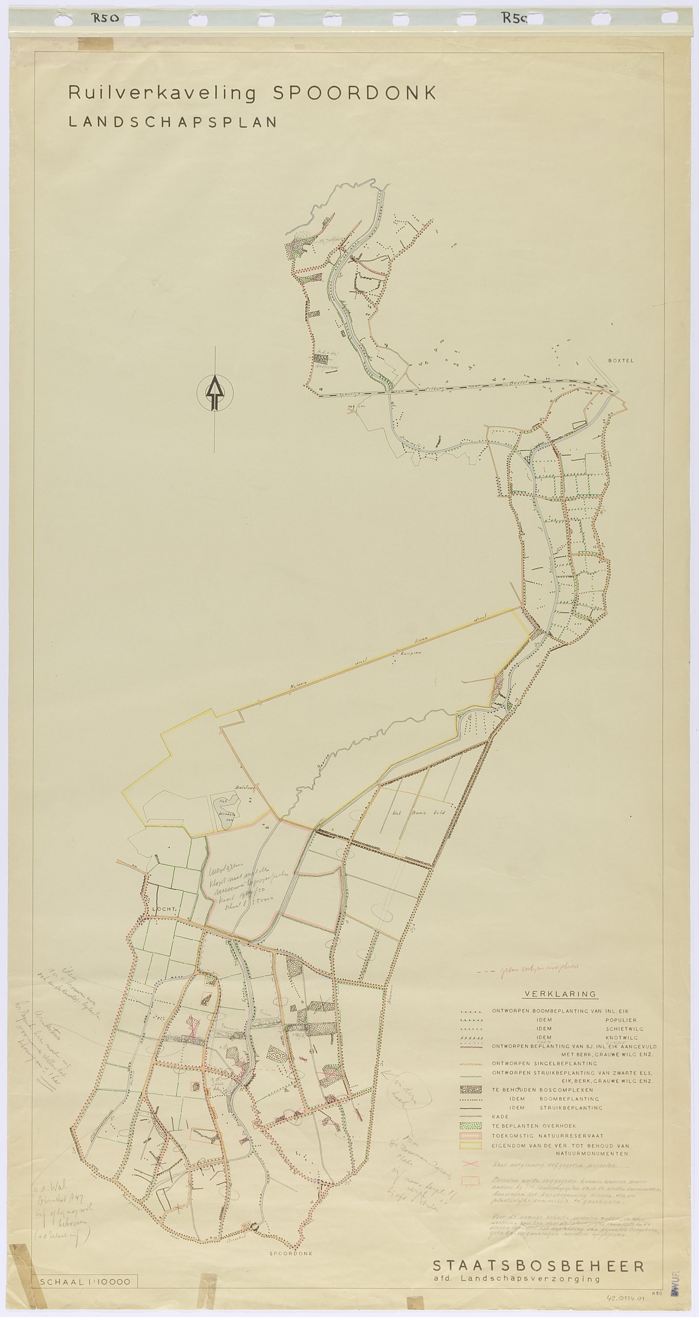
Landscape plan Lieshoutsche Beemden en Beeksche Akker, made by R.J. Benthem, from March 1946 is the oldest plan in the collection. The drawing of the plan Spoordonk, made by Benthem and H.W. de Vroome, dates from 1948.
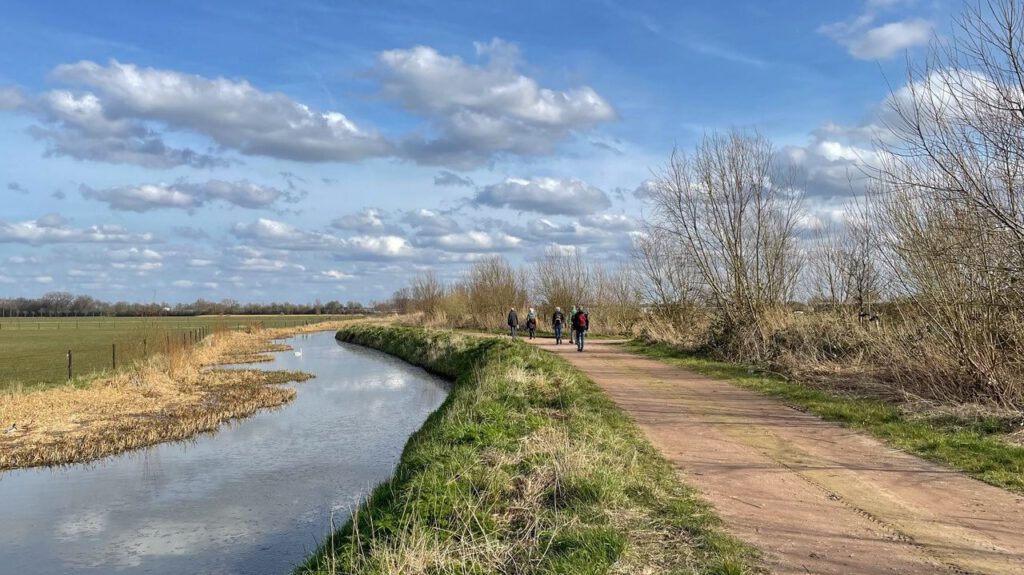
These plans are examples of land consolidation in the “oudehoevenlandschap” (old farms landscape) of Noord-Brabant with scattered farms and fields between low wet meadows and higher heaths.
The difference between village, meadow, arable land and field – each with its own type of soil – was taken as the basis for the new functional layout. In addition to new plantings, existing yard plantings, landscape elements that had to be maintained, and roads with trees and shrubs were included. Only the meadows that were planted cannot be found in the current landscape.
Along the edges of the arable lands or crop fields are “roads with designed one-sided planting of native oak with shrubbery as undergrowth.” By planting the edges of these crop fields in this way, the existing steep edges were preserved as part of the planting.
Strips of shrubbery along the streamlined waterway were proposed at intersections with roads within the land consolidation. Poplars or willows were also proposed along the bends in the stream’s route.
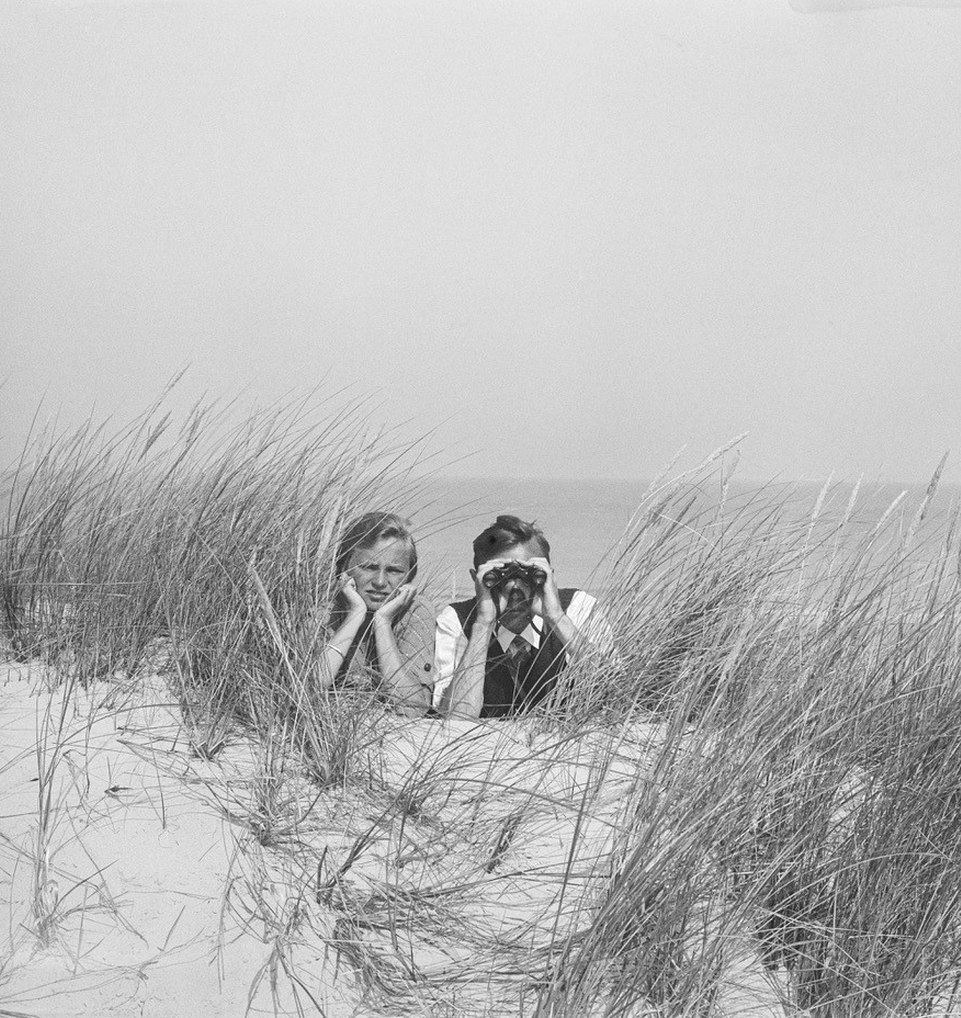
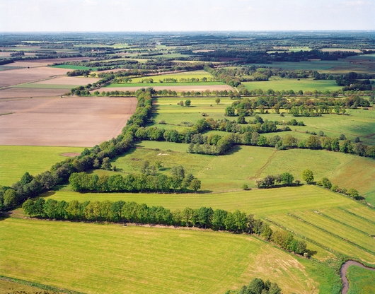
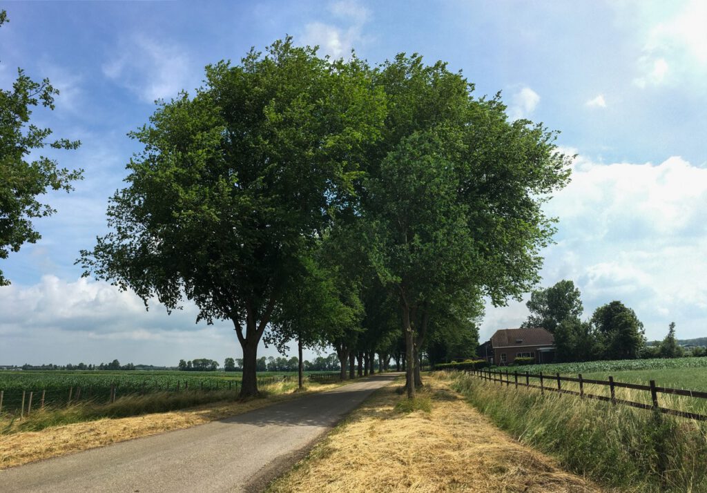
Winterswijk (Gelderland). Photo: Peter van Bolhuis
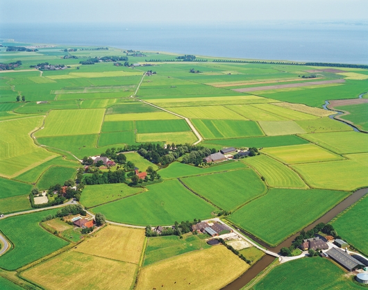
Landscape of mounds / Terpenlandschap
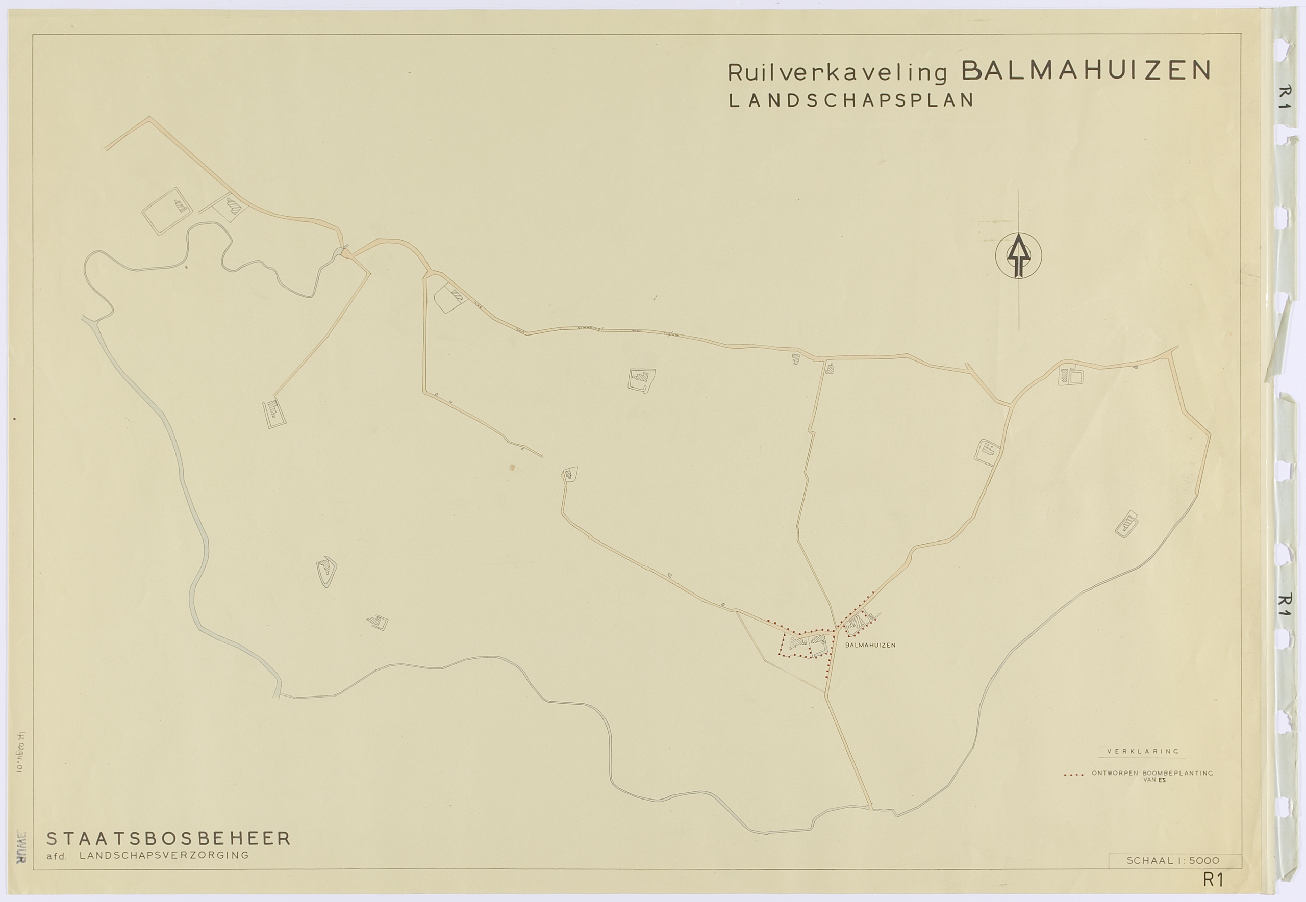
Balmahuizen was one of the first designs Harry de Vroome made in 1948.
The “terpenlandschap” originated from a Wadden Sea where thousands of years ago people built terps or mounds on the higher salt marshes to keep themselves and livestock dry at high tide. The contrast between the salt marsh plain and the terps is the most important characteristic in this landscape type.
The plan for Balmahuizen includes only trees along the road close to the few farmyards on the mound. The trees are placed in the verge opposite the yard. Furthermore, only the plantations around the farms are indicated.
All other roads remain unplanted. This is a conscious designer’s choice as the unplanted road is a compositional element.
The planting of the road on the mound of Balmahuizen has only been placed on the opposite side of the (farm)yard. By starting this one-sided planting slightly in front of the yard, it is experienced as the entrance to the enclosed space of the farmyard.
This detailed design of the contrast between ‘inside’ and ‘outside’ in the landscape is typical of De Vroome’s design approach. It builds on the principles of the English landscape style, which he had mastered in Frederiksoord.
Other landscape plans for the terp landscape, such as at De Kolken in Friesland (Vlieger and/or De Vroome, 1952), show the same design concept.
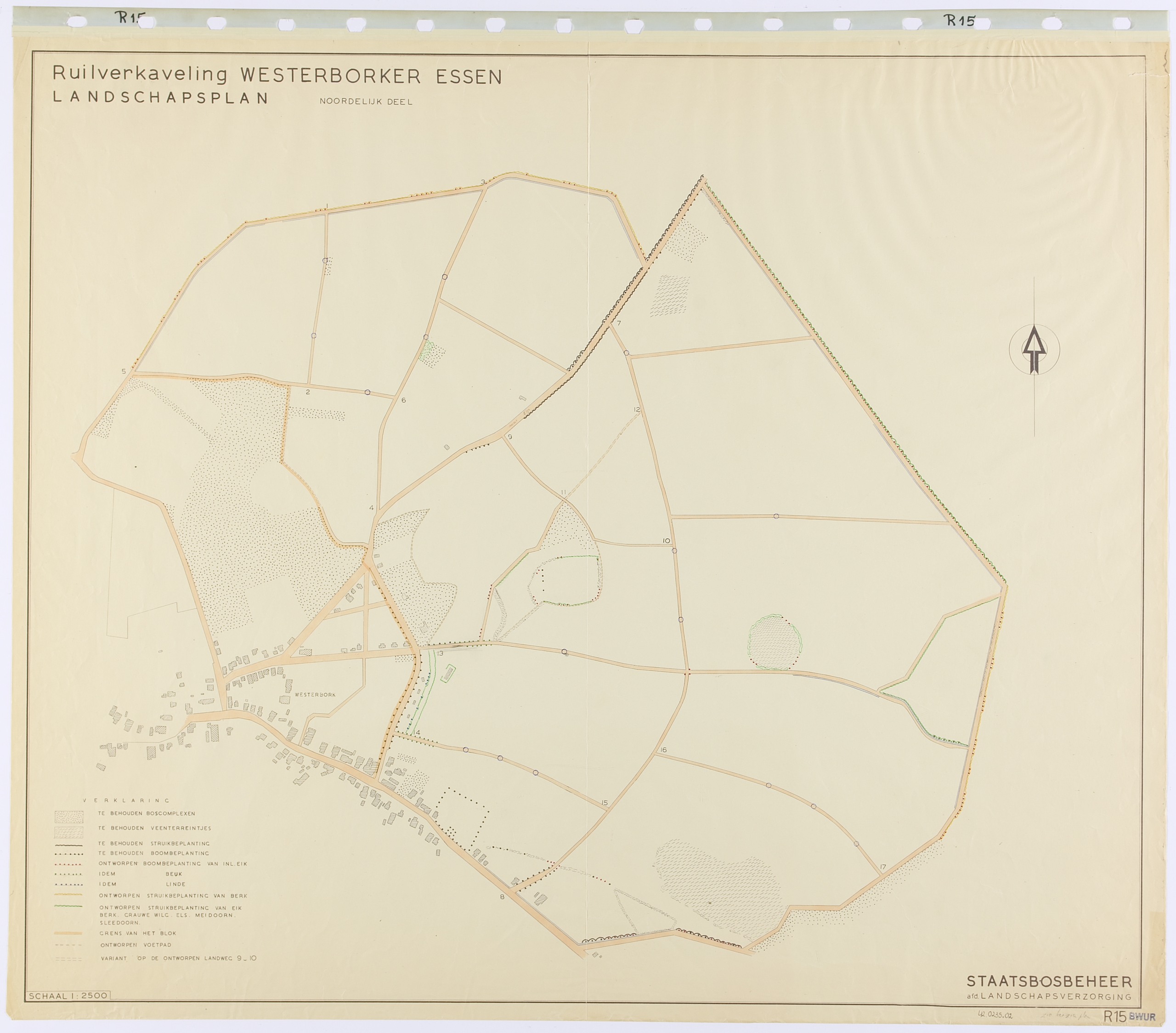
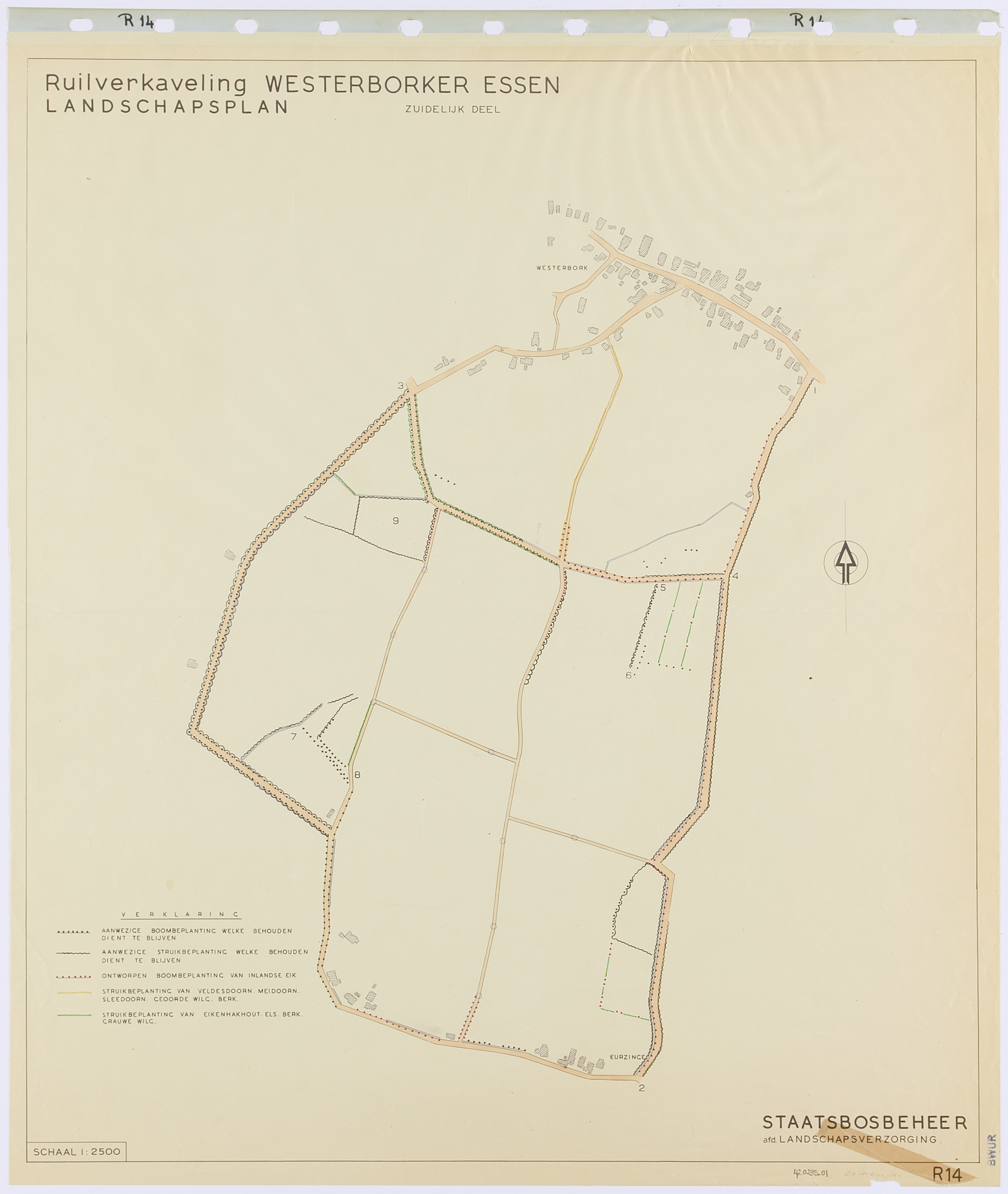
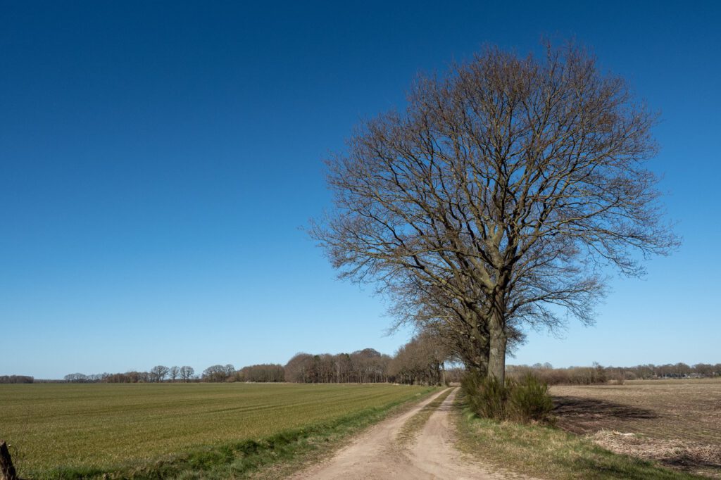
An “es” is a field complex near the village. For centuries, these fields were divided into many long narrow plots that were plowed and tilled with horses. Due to the land consolidation, the plots were widened so that they could be worked with a tractor.
In the landscape plan, the “essen” were emphasized as large open spaces by preserving and expanding the plantations along the edges. The vegetation consisted of oak trees with shrubs underneath and was mostly along partly newly constructed roads. Efforts were made to create a continuous border as much as possible. Sometimes existing groves, alongside new groves, were included in the plan.
In many places in Drenthe, but also in Overijssel and Gelderland, this concept was applied for the new “esdorpen” landscape. The esdorp plantations designed by De Vroome with village greens and their ashtree borders, over a hundred in total, can be found in these provinces.
De Vroome made the villages an integral part of his landscape plans. Many green plantations date from the time of land consolidation.
Because the design concept for the esdorp was consistently applied , it is now generally assumed that esdorpen have looked like this for centuries. This ‘typical esdorp’ is seen as part of our cultural heritage, when, in fact, the origin of these villages is rather recent.
In the landscape plan of Westerborker Essen (1948), Harry de Vroome also proposes a footpath. The walk through the landscape is designed as a walk along a series of ‘scenes’ in which historical landscape elements have been included that can be experienced.
By including the walking route in the public space, De Vroome links the tradition of garden and park architecture (Springer, Hartogh Heijs van Zouteveen, Overdijkink and Pannekoek) to the design of public space in the modern new landscape.
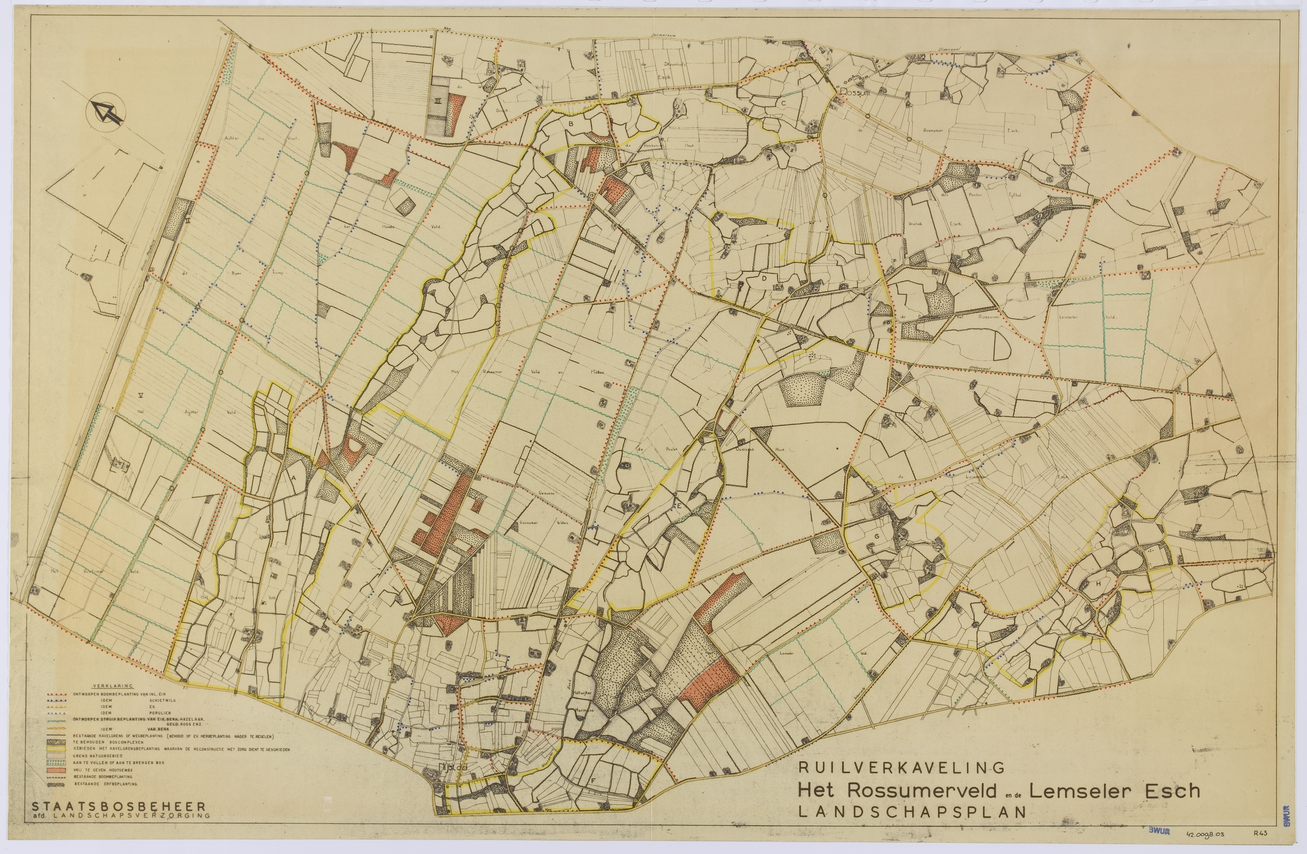
The landscape plan for Het Rossumerveld en de Lemseler Esch (H.W. de Vroome, 1949) in Twente shows the new design for the heathland reclamations that was developed in 1948 and 1949. An interplay of old plantings, careful tracing of new roads and planting provides an interesting experience of the landscape. With canals and rows of trees, the field is transformed into an agricultural landscape with a succession of green rooms.
In 1949, Benthem and De Vroome gave the board of the provisional Nature Conservation Council and representatives of the agricultural sector and Staatsbosbeheer a tour of the Rossumerveld. This meeting was intended to prevent the exploitation of several important natural areas in the ‘most vulnerable part of Twente.
De Vroome probably had a first version of the landscape plan ready at time of the excursion and might have elaborated on it during the excursion. The foresters could no doubt envision the landscape on the landscape plan. The question is whether the others could – or wanted to – form an image of this new Twente landscape. Maybe even Benthem and De Vroome, as nature lovers, had mixed feelings on the project. They will have realized that the fields of peat fluff would disappear.
De Scheeken (Noord-Brabant). Photo: Peter van Bolhuis
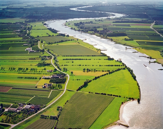
River landscape in Gelderland / Gelderse stroomruggen
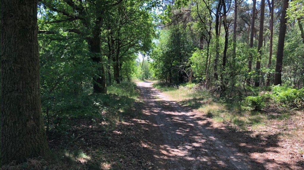
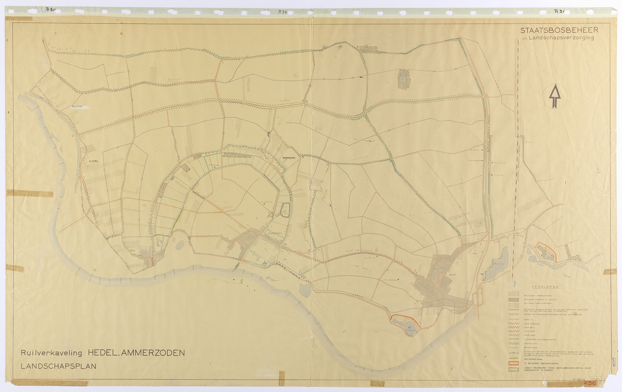
An early Gelderland land consolidation is Hedel-Ammerzoden. The landscape plan was completed in 1947, according to the annual report of Staatsbosbeheer, and was planted in the winter of 1948/49.
Several publications comment upon the “deteriorated land” in the river area before the land consolidation. The farms in the villages destroyed by war were replaced by new farms on the outskirts of the village.
In the swampy basin clay areas, the allotment was modernized and the water management and the road pattern were greatly improved. Initially, no farms were moved to the basin.
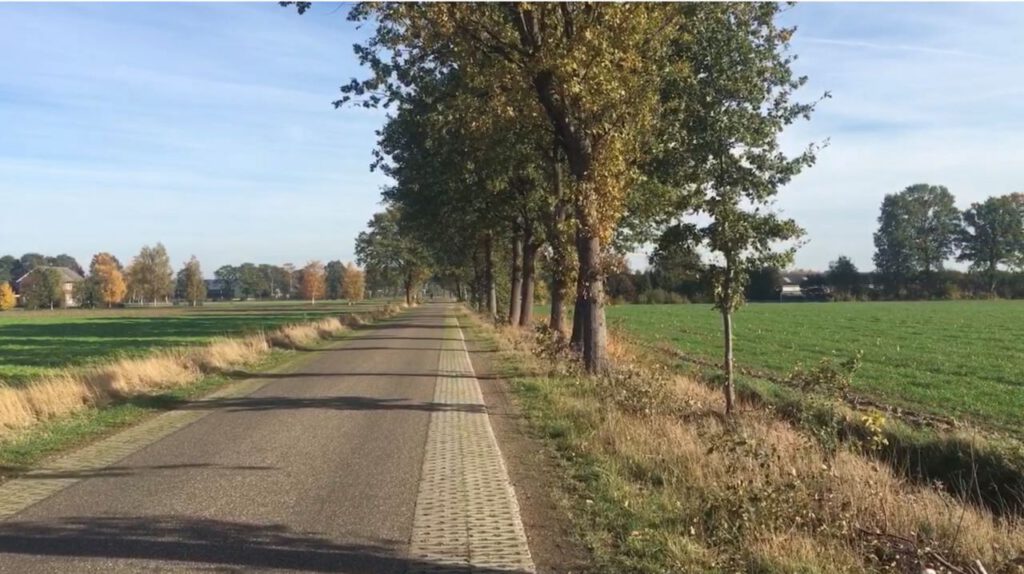
In Hedel-Ammerzoden, the roadsides of the new roads laid through the reclamation of the basin are completely planted with long screens of poplar and ash. Cultural-historical elements, such as old dikes and the old monastery and castle grounds in Ammerzoden, are also carefully considered in the design. Some historic duck decoys have been spared in the basins.
Striking in Hedel-Ammerzoden is the structuring role of the old river meander. The two long curving roads on either side are lined with sturdy road plantings. The landscape plan also states that the edges of the plots along the old meander should also be planted.
More information on Hedel-Ammerzoden is available in database TUiN.
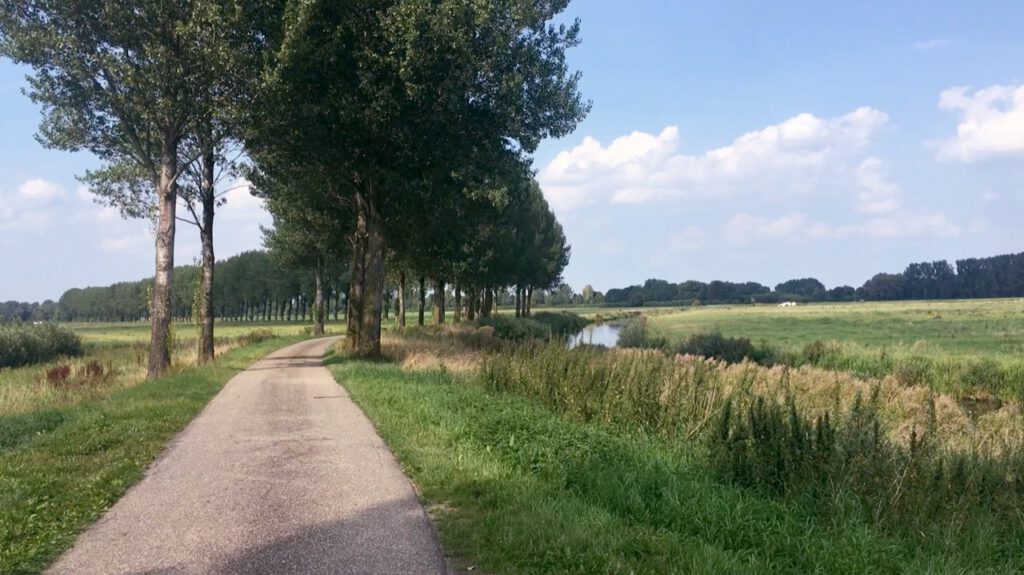
De Lek bij Achthoven (Utrecht). Photo: Peter van Bolhuis
River landscape in Brabant / Stroomruggenlandschap in Brabant
In the river area of Brabant six land consolidations were prepared in the Beersche Overlaat. The Beersche Overlaat is where the Maas created an extra discharge route in the event of heavy precipitation. This spillway was closed after the Maas was canalized in the 1930s and the dykes along it were reinforced.
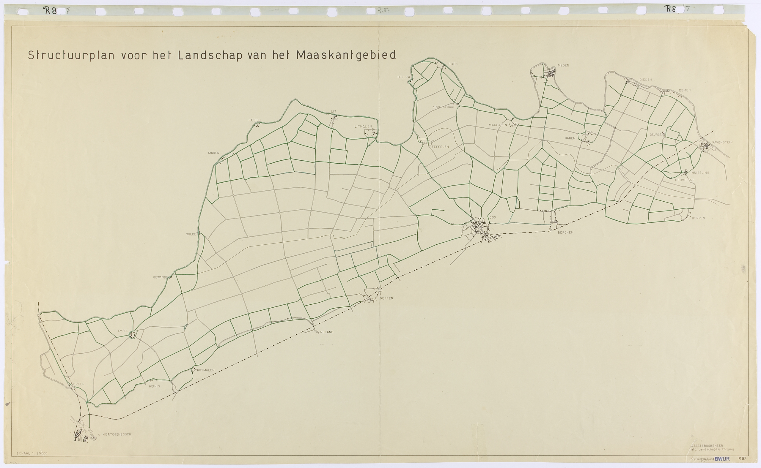
For Benthem, the landscape plans for the six land consolidations had to be part of a single design. He had Nico de Jonge (1920-1997) design a Structuurplan for the entire Maaskant area.
The plan shows a clear contrast between open and closed areas. At the northern and southern edge of the large open space, planting was projected along the roads, as well as in the villages. At that time, no farms were built in the basin.
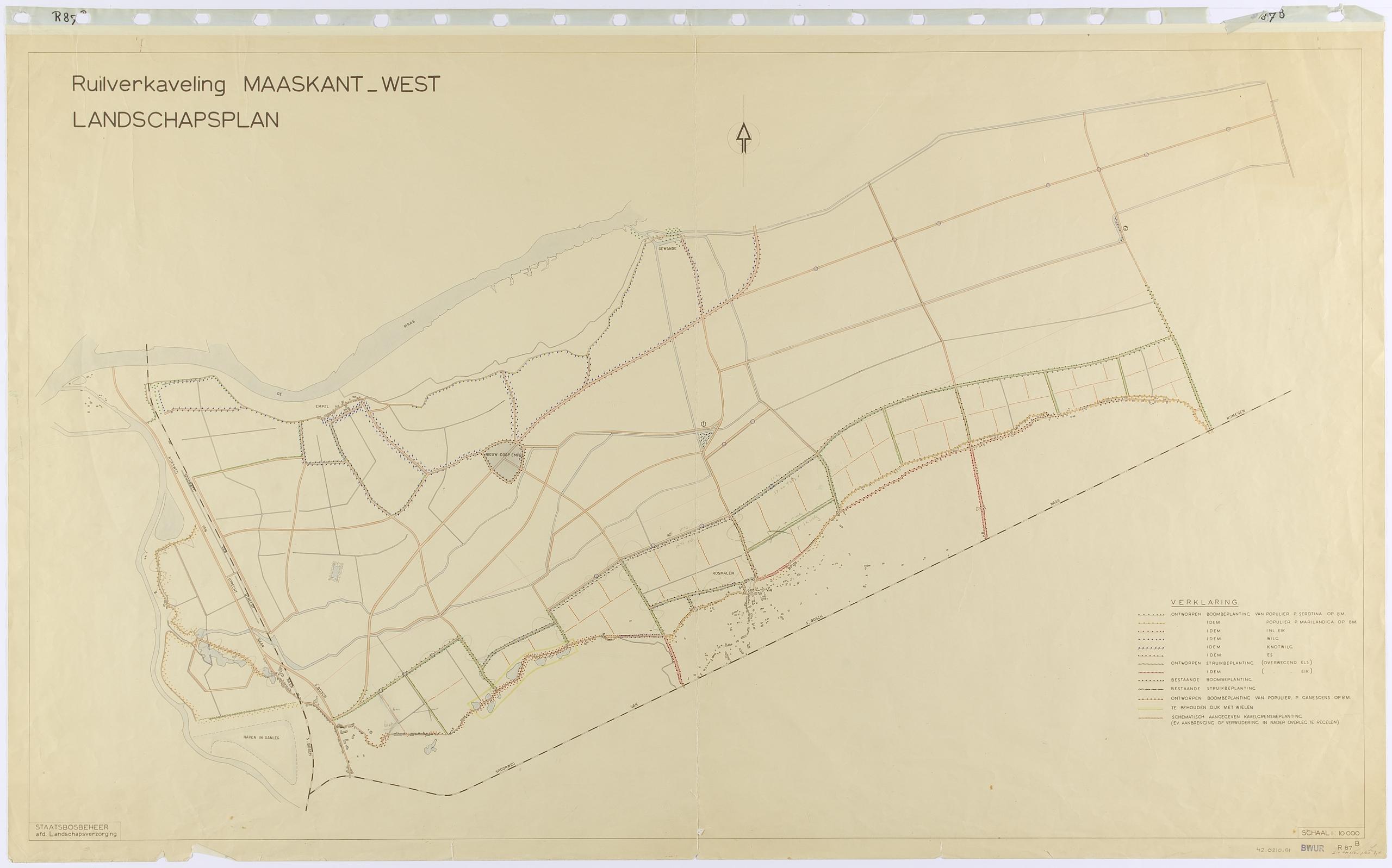
Maaskant-West was the first of the six landscape plans based on the structure plan. The western half is bound by dykes: the Maasdijk in the north, and other dykes along the valley of the Aa and Dieze in the west and south. These dykes, as well as the wheels attached to them and the first roads inside the dykes, were planted. Pollard willows were planted along the Maasdijk and poplars at the Diezedijk. Along the southern dyke, oaks were proposed on the edge of the Brabant sand.
The roads on the embankment along the Maas were given pollard willows, sometimes underplanted with alder bushes. The road that runs on the transition to the basin had ash trees in the verge. Ashes were also projected in the south along the sand into the village centre of Rosmalen. The roads were not planted between the levee and the sand. Here you will still find the wide open basin of Brabant.
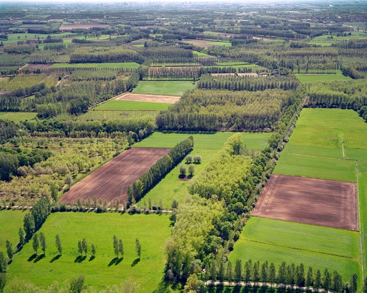
The landscapes of the Zeeland and Zuid Holland islands and West Brabant consist of a succession of small polders in a lagoon. Here, due to the tidal action, new land was silted up to become salt marshes and mud flats. When those salt marshes had silted up high enough, the sea also deposited a fertile layer of sea clay. With new dykes around these accretions, land was reclaimed in the form of fertile marine clay polders, called ‘nieuwland polders’.
For centuries, various rivers and Brabant streams flowed into the estuaries of the sea. Often the sea swept away pieces of the polders and when dykes were breached, wheels and creeks formed in the polders. If the polder dykes could be restored, those creeks would be located in the “nieuwlandpolders”. Landing and reclamation started again outside the dykes. Over several centuries, the last estuaries were dyked.
From the end of 1944, priority projects were carried out to repair the landscapes of Zeeland and West Brabant damaged in WW II.
A structure plan was drawn up for the landscape of the West Brabant clay area. The old erratic polder dykes were planted with trees. In contrast, the dead straight ‘checkerboard’ roads in the polders between the arable lands were left unplanted.
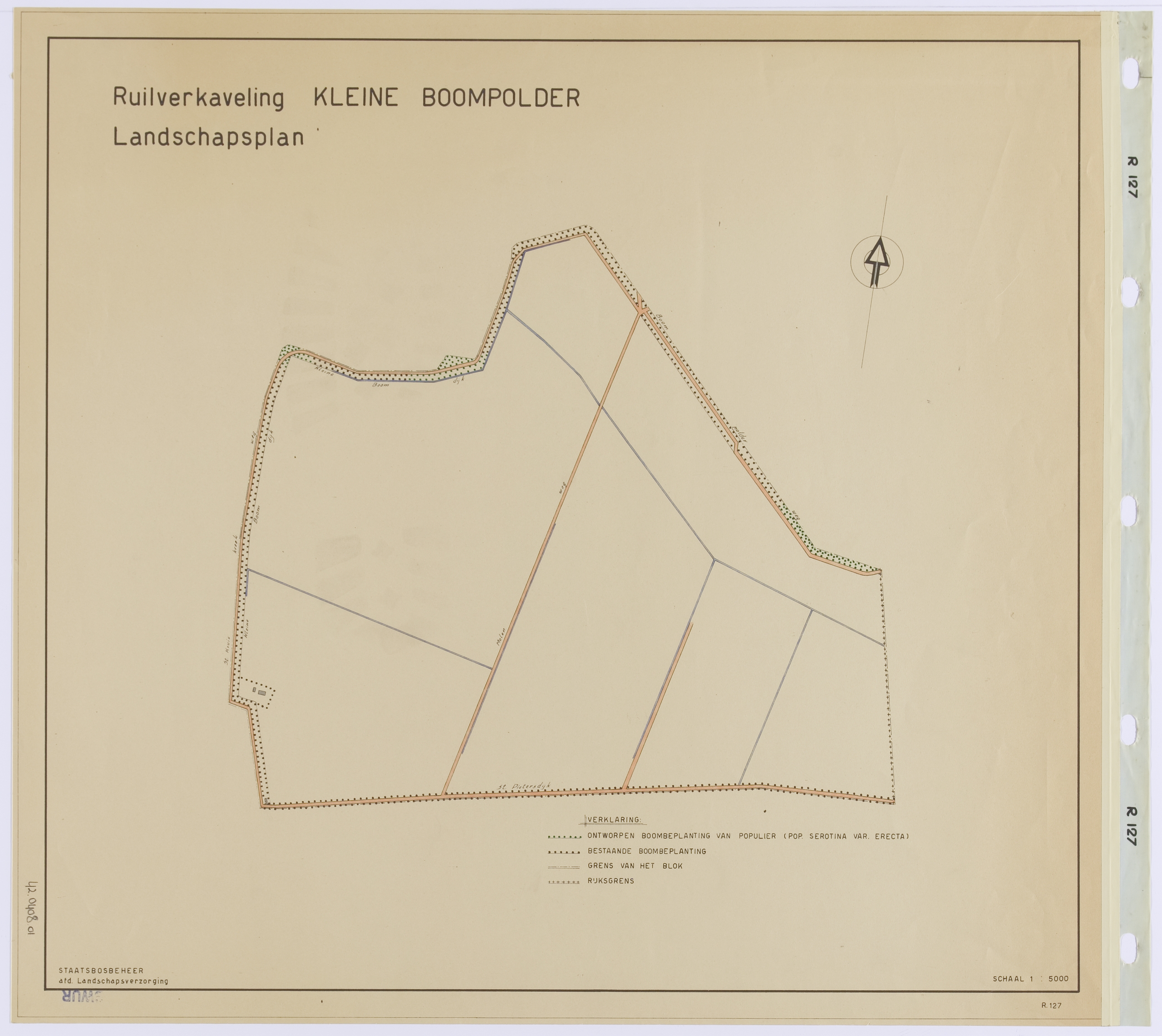
In the landscape plan Kleine Boompolder (1952), located in Zeeland, this design concept is also applied by Nico de Jonge.
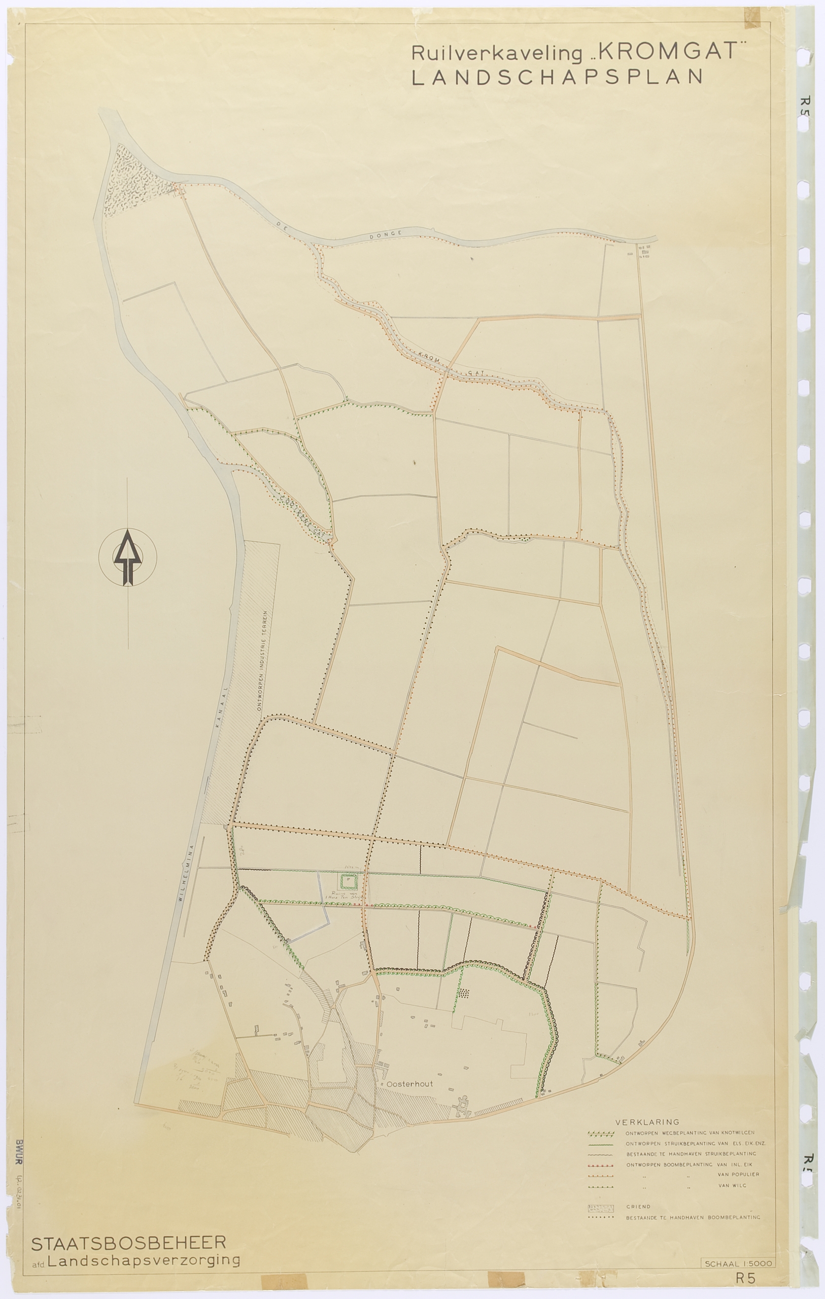
Strikingly, Benthem does not mention the creeks when describing the structure plan of West Brabant. In one of the oldest landscape plans, that for Kromgat (1948), it is precisely those creeks that play the leading role. In the Kromgat design these creeks are bordered with new plantings.
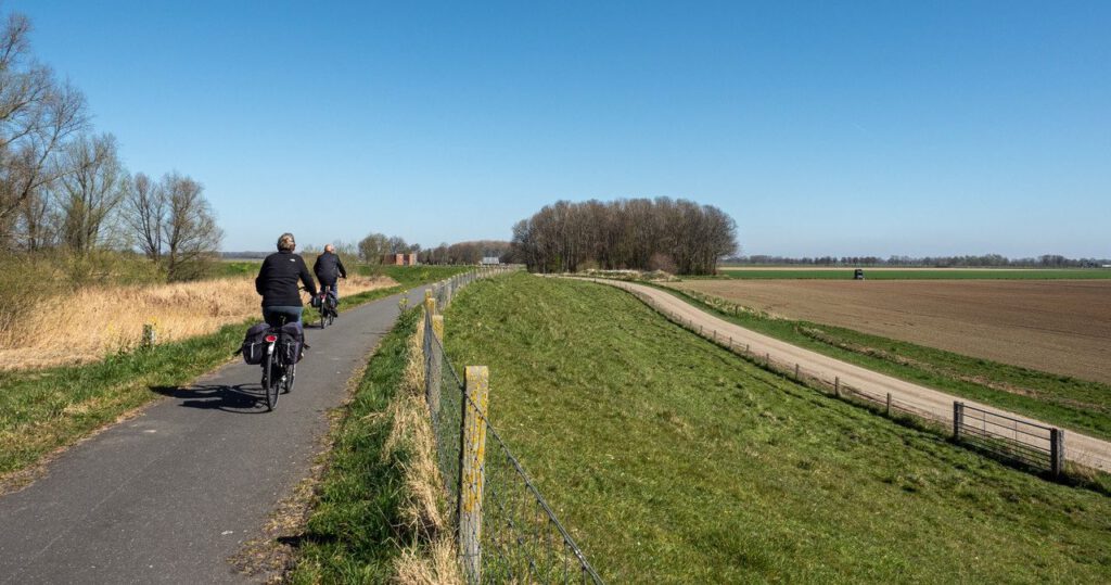
At this moment, the plantings of the dikes are again under great pressure.
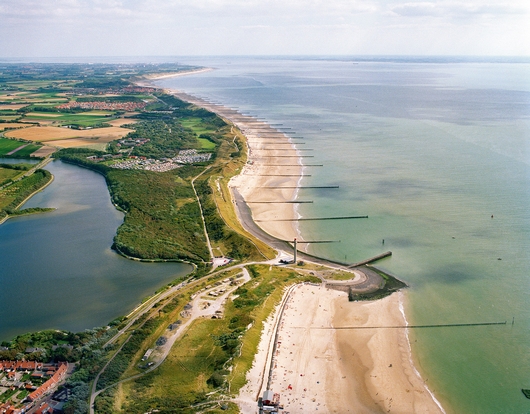
Zuiderhoofd Westkappelle (Zeeland). Photo: Peter van Bolhuis
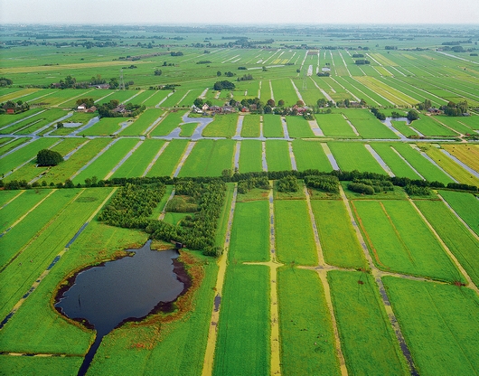
The moor consolidation landscape / Slagenlandschap
The Dutch term ‘slagenlandschap’ is a collective name for many landscapes with long narrow plots in former swampy transition zone between higher areas (often with sandy soils) to lower marine clay areas.
These plots were mined around the so-called road villages (in Dutch: wegdorpen). These residential ribbons can be regarded as closed edges of open areas. A main characteristic of this landscape is the variation from enclosed landscape to open landscapes.
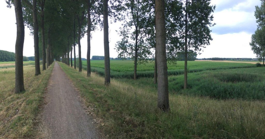
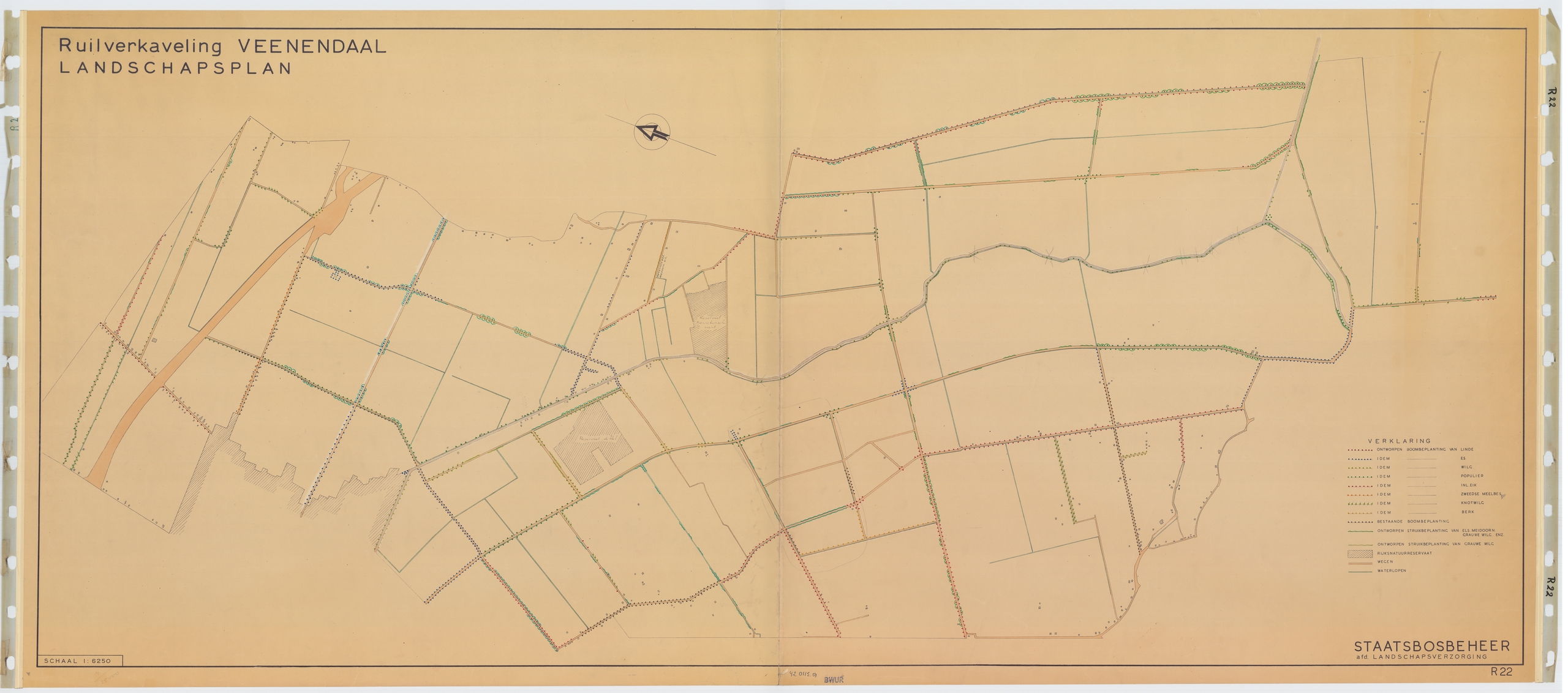
In the landscape plan for land consolidation in Veenendaal (1947), Benthem ensured that the new plantings formed spaces that were small close to the moraine and which gradually became larger towards Het Binnenveld. At the Grift you have a wide view of the Veluwerand in the east and the Heuvelrug in the west.
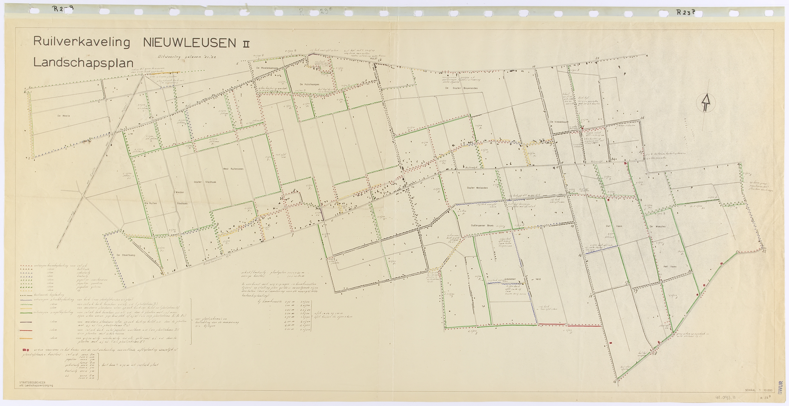
In the landscape plan for Nieuwleusen II (1949), De Vroome added another element by rows of plantings along the backs of the village ribbons and thus designing a series of ‘village courtyards’.
The design for the Eemnesser Polders, also from 1949, was created from yet another approach. The Noordoostpolder lay beyond the horizon, 50 kilometers away on the other side of the IJsselmeer.
The maker, Nico de Jonge, is looking for contrast and extremes. Not a gradual transition for him, but rather – coming from the enclosed privacy – a sudden confrontation with the horizon.
Instead of the zoned arrangement of increasingly larger spaces, in this plan a great contrast has been achieved between the closed edge of the Wakkerendijk and the enormous expanse to the east of it.
The plucked vegetation near the wheels and the dyke forms a transparent ribbon that ensures that the expanse also extends to the east and north sides of those dykes.
Polder Middelblok, Krimpenerwaard (Zuid-Holland). Photo: Peter van Bolhuis
Photography
Most landscape photos were taken by Henk van Blerck.
The aerial photos were made by Peter van Bolhuis.
The other photos are part of the private collections of the relatives of Benthem, De Vroome en De Jonge.
We thank everybody for their permission to use the images.
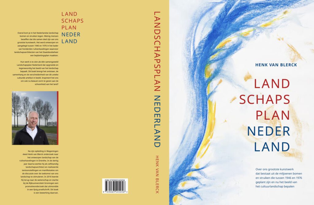
The dissertation
Want to read the dissertation, in Dutch, of Henk van Blerck on which the exhibition was based, go to Landschapsplan Nederland to lend it from WUR Library.
Blerck, H.J.J.C.M. van (2022). Landschapsplan Nederland Over de ons grootste kunstwerk dat bestaat uit miljoenen bomen en struiken die tussen 1946 en 1976 geplant zijn en nu het beeld van het cultuurlandschap bepalen. Schokland en Water, Rhenen. isbn 9789083245058. Go to www.landschapsplannederland.nl or mail to info@schoklandenwater.nl for a summary in English.
Henk van Blerck will tell about his research and the exhibition in the reading room of Special Collections and organizes a bicycle tour in Het Binnenveld on Thursday 30 March from 9.30 till 13.00 pm. Click here for more information and the application form (in Dutch)
Other online exhibitions from WUR Library – Special Collections